Showing posts with label Stoke-on-Trent. Show all posts

19 Oct 2011

Ceramics: A Fragile History (TV Series)

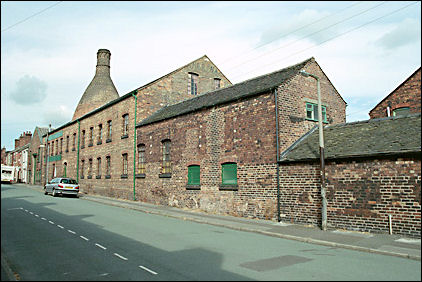
A new series on BBC4 called "Ceramics: A Fragile History" has been documenting the ceramics industry in Britain. The second episode, aired on Monday 17th October 2011. The 60 minute documentary is described as follows:

"This second film charts the rags to riches-to-rags epic of Stoke-on-Trent, a city built on clay and the heart of Britain's once world-beating ceramics empire. On the back of the 17th century phenomenon of tea, pottery in Britain exploded into a cutting-edge industry and a source of enormous national pride. We meet the key characters responsible for putting British ceramic art on the map: from Josiah Wedgwood, innovator, artist and marketing genius, and Josiah Spode (who made it his life's work to invent a British version of Chinese porcelain and came up, aged 60, with bone china, which revolutionised the industry) to the great 20th century ceramicists Clarice Cliff and Susie Cooper. We see how demands for cheap labour since the 1980s have forced the closure of all but a handful of these great factories, leaving Stoke's crumbling overgrown ruins as our Pompeii. Contributors include AN Wilson, Neil Brownsword, Lucy Worsley, Miranda Goodby, Emmanuel Cooper and Matthew Rice."


The show is available to watch on the BBC iPlayer until Monday 31st Ocotber 2011 here.

12 Oct 2011

A few supplementary points added to survey of tick sheets

Physical, practical and psychological aspects must be thoroughly treated and then enhanced with valuable layers through work on city qualities (both visual and pragmatic), which can root people in the space-----means city space perform well.

Physical:
(1)Safe

Street light;
CCTV;
Separated road of different functions or shared road;
Pedestrian’s priority (continuity of the pavement);
Consideration for bicyclist;
Warning boards and signs;
Window light at night;
Gate and fence;
Transition from public to private (semiprivate space for interaction);Car-free areas (St linked to the main road of Victoria Rd);

(2)Green
Gasoline used (number of cars);
Climate: humidity/wind chill (low buildings and trees alongside can reduce the strength
of wind)/solar heat/average temperature;
Lighting;
Litter bins distribution;
Bus station (How large is area that a bus station need cover?);
Plantations;


Practical:
(3)Healthy

Sedentary and moving activities;
Exercise space;
Noise;
Sunlight;
Proportion of walking/bicycling/public transportation/private car;
Pollution;
Proportion of the road-----traffic lane, bicyclist, pedestrianism (room for walking);

(4)Wealthy
Infrastructure, for examples: bench, plants, bollard;
Varied materials for city’s visualization;
Proportion of necessary activities and optional (recreational) activities;


Psychological:
(5)Sense of Communities

Average size of household, number of residents per hectare;
Community bulletins and boards and signs;
Advertisements for the public community area or infrastructures;
Communication among people on the public space;
The frequency of varied facades in the length of the road;
Human scale or traffic scale;
Street furniture that provides ”talkscapes”;
Unhindered sightlines;

(6)Learning
Artistic display (installations and temporary works for children learning);
Schools;
Educational institutions, for examples: exhibition, art gallery, theatre;

11 Oct 2011

Monday Walking in Fenton

On Monday, I went to Fenton for a pilot study and kept some records by camera. Maybe it’s just a glimpse at Fenton, but I hope this can help build up our desktop stuff and survey tick sheet. Perhaps we can find more about Fenton and things related to the 'tick sheet' methodology.

The following picture showed my route yesterday. Following the methodology from previous posts, I began at the Stoke-On-Trent Railway Station and walked through the south part of Leek Road and City Road, and reached the node which is one of the two ends of Victoria Road. Then walked along the whole Victoria Road and turned to the north part of Leek Road, back to where I started.

Route taken on initial visit to Fenton.

The two ends of Victoria Road are two big nodes with the roundabout connected a series of main roads leading to other parts of Stoke-On-Trent.

Victoria Road can be divided into different parts, because each has their own features, which was reflect in my change of emotion walking down the road. (From south to north)

1. Continuity of the residential area
On the southeast side of Victoria Road is a big area of residential area with some learning schools, so the south corner of Victoria Road is an area when there is transition from a residential area to a main commercial road. Features: residential houses alongside (type); front courtyards between the sidewalk and house (transition); monitor or CCTV in case of theft (safe issue); “Fenton Park” bulletins among residential area (community sense); no trees at all.


2. Combination of Houses/Church/Commercial
Features: boring and unified façade; shuttered doors; narrow road with two traffic lanes; narrow pavement; rarely people stay; no trees at all.


3. Commercial area with a variety of shops
This area basically consists of plenty of shops (clothing, mechanism, food, and supermarket). The width of the road does not stay the same, some of the area needs a little bit for a bigger public space for people to stay (however, with worse infrastructure). Features: colourful advertising bulletin; varied façade; more open and transparent on the ground floor; some awnings outside for people stay; more people walking through the toad; varied width of the road; narrow pavement.


4. Residential houses again with Fenton Park
Some residential houses again appeared along the road, but without front gardens, because the width of the road is too narrow. However, there is Fenton Park alongside, which is big green space, not only connected to Victoria Road, but also connected to different residential communities in the east area of Victoria Rd, which consists of lots of residential houses. The park must be the center of Victoria Rd, however, the space in front of the gate of the park is limited, with only a bust station near the gate. Features: Fenton Park, the mark of “Fenton” (community sense); green and environmental; people stay in the space for a long time (optional activities and recreational activities).


5. Fewer buildings with more grassland and trees
It is an area which transitions from the intensive buildings to less density, which give it a bit more space for grass and planting trees, which definitely contrasts to previous parts of Victoria Road, with little plants. But alongside are fences and brick walls, which get in the way of the view or interaction between people as well as people and buildings. Fewer residents showed up or walked by. Features: more plants; less density; clear boundaries defined by brick walls and fence; fewer people.


6. Fenton Industrial Estate
This space consists of an industrial estate with broader roads and a bigger scale of building and road, which give spaces for the “outside activity space”, which, however, just turn out to be the parking space or the ground with no people at all. A lot of one-storey or two-storey big supermarket and factories alongside and so the view along the road is open, because there are fewer buildings. However the shuttered door and the big scale make people feel less warm, which makes residents just pass by quickly instead of staying. And also, few people walk on this part of Victoria Road. Features: big scale; broader road; big media advertisement bulletin and bigger slogans; few people walking; big burden of traffic; more private cars; strong wind.


7. Small scale of shops and residential houses back again
When getting closer to the node of Leek Road and Victoria Road in the north, the corner space is filled with small scale buildings along the road.


Other observations of Victoria Road:
Bus stops are limited with a long walk between each bus station; more private cars than public transportation (not green and not sustainable as there is less walking); no lanes for bicyclists (bicycle and car even share a road which is dangerous and there are fewer bicycles); little infrastructure (benches, bollards, monuments, plinths of flower bed) for people stay in a space except for the fenton park

Other parts of Fenton (Leek Road, City Road, King Street):
At the intersection of City Road and Leek Road, I found this bulletin which shows "Welcome to Fenton”.


It is interesting that the bicycle lanes sometimes share the road with car, and sometimes share the road with pedestrian, which is really dangerous.


There is more traffic than people walking and bicycling (not healthy), and there seems to be fewer optional or recreational activities outside (not lively).

Planning Policy for Fenton

Fenton lies on the boundary between the Stoke-on-Trent Inner Urban Area Spatial Strategy and the Stoke Outer Urban Area Spatial Strategy, with the eastern boundary to the Inner Urban Area defined by Fenton Manor, as set out in the Newcastle-under-Lyme and Stoke-on-Trent Core Spatial Strategy Document 2006-2026 (adopted 2009). However Fenton is covered by the strategies set out for the Outer Urban Area.

Stoke Outer Urban Area Spatial Strategy

The strategy sets out the following visions for the Outer Urban Area:
“The Strategy will provide for increased vitality and vibrancy of Longton, Tunstall, Fenton town and Meir centres and improve accessibility and availability of modern local facilities.  Housing growth will be focused to address specific regeneration priorities at general densities of 50 dwellings per hectare, and the creation of new employment opportunities through major new development will maximise economic potential.  Regeneration of the Outer Urban Areas will create sustainable communities, which complements the major growth planned for the City Centre and Inner Urban Core. Tunstall and Longton will continue to provide important district centre facilities serving the north and south of the City.  Fenton and Meir remain as important centres in their own right. The character form and function of older residential areas will be improved and steps taken to improve and diversify the tenure of many social housing estates built in the suburbs of the City.”
Within the strategy Fenton is defined as a Significant Urban Centre that "derives its town centre designation because of its historic role, rather than its retailing provision which is more characteristic of a local centre." Its current retail provisions is described as "limited" and there is "scope for an additional 500m2 of retail development, to serve a local catchment only." Furthermore Fenton is to serve as "a sport and leisure focus for the City", possibly because of the Fenton Manor Sports Complex and its close proximity to the Britannia Stadium.

Local Development Framework City of Stoke-on-Trent Proposals Map.
Detail of Fenton and surrounding area.

The 2011 Quick Guide produced by the Planning Department states that any area not covered by the City Centre and Etruia Road Corridor Area Action Plan or Inner Urban Core Action Plan will be covered by the Portfolio Development Plan Document. This document is currently under production is due to be published sometime in Ocotber 2011 and as such the most relevant information pertaining to Fenton has so far been found in the LDF document and proposals for the Outer Urban Area.

Earlier guidance, specifically the Revised City Plan 2001, designated two areas of wildlife interest in Fenton at the Manorfields Pool (Fenton Manor) and Smith's Pool, Fenton Manor was also highlighted as a site of particular known nature conservation interest. It also described two Local Centres (a third tier ofdesignation below Regional and District Centres) within Fenton: Kwik Save, 37-75 (odd nos) & 48-114 (even nos) Victoria Road; and 239-321 (odd nos) City Road, 5-15 (odd nos) & 2-26 (even nos) Christchurch Street, 7-17 (odd nos) Manor Street, & 2 Fountain Street.

Planning Policy for Stoke-on-Trent

Planning Policy for Fenton is set by Stoke-on-Trent City Council and provides a framework to "guide and control the development of land and buildings in the area", it also "sets out proposals as to how it should develop in the future." The Planning Policy Team at the Council maintains a number of documents, including the Local Development Framework or LDF (in time this will replace the City of Stoke-on-Trent Local Plan of 1993), which sets out of the guidelines and can be used to assess planning applications. There is a hierarchy to these strategies, with a number of Supplementary Planning Documents (SPDs) which "provide greater detail on the planning policies produced by Local Authorities". The Local Development Scheme is the "keystone" to the Local Development Framework and is a management document that enables the public to find out what planning policies are currently in force.

Hierarchy of the Local Development Framework in the City of Stoke-on-Trent.

The new Government has "clearly signalled their intention to rapidly abolish Regional Strategies" but as legislation regarding this abolition is still emerging these policies will still have a standing on development. As such the Stoke-on-Trent City Council will continue to use targets set out in the adopted (2009) Newcastle-under-Lyme and Stoke-on-Trent Core Spatial Strategy. This strategy "provides the foundation for detailed modern planning policy and supports delivery of North Staffordshire Regeneration Partnership and regeneration priorities in the City and North Staffordshire."

Newcastle-under-Lyme and Stoke-on-Trent Core Spatial Strategy

The Council is currently working on three strategic documents (as of Spring 2011): The City Centre and Etruia Road Corridor Area action Plan; the Inner Urban Core Area Action Plan; and the Development Portfolio DPD (or the Outer Urban Area). These new plans will guide development over the next 10-20 years with the aim being that: "‘The Borough of Newcastle-under-Lyme and the City of Stoke-on-Trent will be a prosperous, vibrant, environmentally responsible and successful area of choice for businesses, visitors and residents in the period up to 2026."

Strategic Sub Areas (adopted 2009)

The LDF states that "The polycentric nature of the conurbation means that the plan area contains a number of highly distinctive centres." It sets out a number of Strategic Centres (including the City Centre of Stoke-on-Trent defined by the "traditional core city centre bounded by the Potteries Way Ring Road"), Significant Urban Centres (including Fenton), Local Urban Centres, Rural Service Centres and Villages.

LDF City of Stoke-on-Trent Proposals Map (North and South combined)

Furthermore the LDF adds that:
"The physical, social and economic landscape of the plan area is extremely diverse, and presents a multitude of different challenges and opportunities.  To ensure that the Core Spatial Strategy addresses these challenges and opportunities efficiently and comprehensively, the plan area has been divided into six distinct strategic sub areas."
Each centre is to have a clearly defined role within the wider spatial strategy.

Strategic and Spatial Strategies Diagram

For a summary of Planning Policy in the City of Stoke-on-Trent see the following quick guide, produced by the Council in January 2011, here.

10 Oct 2011

Moving Forward

Following the pilot studies, conducted in Manchester last week, attention now turns back to Fenton. On Friday, during a Studio Tutorial we reviewed our mapping methodologies, refined it and the developed a strategy for documenting Fenton.

1. Review of discussion with studio tutors.

The first stage involved a discussion with our studio tutors, reviewing the pilot studies and what data was collected. This discussion continued amongst the group and a few key methodologies emerged, including the desire to develop a form of 'tick sheet' or survey that could be carried out along a route in Fenton. The intention would then be to 'graft' this data onto two-dimensional (in the form of plans and sections) and three-dimensional 'segments' of the route.

2. Key themes each group member wanted to pursue.

However, the exact nature of the study (what data would be collected) was less clear and as such the group went 'back to first principles' and identified the key topics that each member was interested in studying. Areas of similarity and cross over were quickly identified and a condensed set of key themes emerged: Perception, Infrastructure, Control, Regulation, and Scale.

3. Key themes and looking for connections.

The next stage involved identifying a loose research question or statement. The key themes were also further explored as was the idea of 'reduction' and how this could be applied to the themes and data collected. At this stage the notion of layering became prominent, with the intention to collect a wealth of data that could be layered to reveal new or previously hidden relationships.

4. Developing relationships between key themes.

In attempting to define a methodology to reveal the latent characteristics of a place (through the layering of different datasets) the idea of performance was also important, how does space perform?

5. Exploring planning policy relevant to Stoke-on-Trent.

The group then took a sideways step and began discussing current policy that is affecting the wider urban area of stoke-on-Trent, particularly planning policy. Research into Local Development Frameworks for Stoke revealed that Fenton lies at the boundary of two strategic areas of the city: the Inner Urban Core and the Outer Urban Area. It also revealed a proposal in which a future Stoke was defined as the following: a Healthier City; a Learning City; a Wealthier City; a Strong Sense of Community; a Safer City; and a Green City.

6. Mapping the key themes and relevant policy areas.

These six categories provide an interesting lens through which to study the Fenton area. If the intention is to improve Stoke in relation to these characteristics then it is possible to assess the current urban fabric in relation to these categories. Using the previously mentioned tools of tick sheets and surveys the intention is to document a route through Fenton in terms of these six categories. This data will then be grafted onto a three dimensional scaffolding that may reveal particular physical characteristics in the urban form that lend themselves to these categories. Concurrently a study of the 'perceived' Fenton will be carried out, using the same categories, which will enable the group to draw comparisons. There is also the potential to draw comparisons with idealised models.

5 Oct 2011

Pilot Studies

Before heading to Stoke-on-Trent (and more specifically Fenton) the group has carried out a number of pilot studies in areas of Manchester, testing out various different methods of data collection and mapping techniques. The purpose of these pilot studies is to test the various methodologies and review the outcomes of initial forays into the city, including: route and starting point selections; mapping and recording techniques; short tests and reviews of the proposed methodologies; and assembling hardware (maps, cameras, measuring equipment, etc).

Two locations were chosen, Clayton and Trafford. These locations were selected because they have some resemblance to the built environment or urban landscape of the Fenton area of Stoke-on-Trent and therefore any pilot studies carried out there should be reliable. Visits were made across three days, with Clayton being visited on Tuesday 5th October 2011 and Thursday 7th October 2011, and Trafford on Wednesday 6th October 2011 and Thursday 8th October 2011. Prior to visiting each location an initial survey of online maps was carried out to determine which particular area to visit and also determine a starting point. Both areas were accessed via public transport so it was decided that the disembarkation points would be the start of each mapping exercise.

No route was planned before visiting, with the decision taken to follow major routes and then make decisions at junctions with other roads/circulation networks as to whether or not a change of direction was needed. The original intention in Clayton (visited first) was to walk a linear route however during the visit it was decided to change this course of action and carry out a circuit/loop, with investigations or forays into the edges of these routes. The data being collected was also revised along the route to reflect what was being seen/found in that area, these lessons were then applied to Trafford (and then further revised).

Clayton

The Clayton Route was approximately 2.3 miles in length, starting at Sport City before moving into the residential areas bounded by Ashton New Road and Phillips Park/The Vale.

The route taken around Clayton on both visits.

Trafford

The Trafford Route was approximately 1.9 miles in length, starting close to Lancashire County Cricket Club before moving into the residential and commercial areas bounded by Warwick Road and Great Stone Road.

The route taken around Trafford on both visits.

Further documentation and results from these initial pilot studies will be uploaded to this blog, accessible via this tag.

3 Oct 2011

The Potteries Thinkbelt Study 1964

Here is a link to some information on "The Potteries Thinkbelt Study" done in 1964 by Cedric Price. 


Cedric Price Master Diagram for the project.


This is what Studio 9, at Sheffield School of Architecture, had to say about the project in 2007/08:
"In 1964 The Architect Cedric Price created 'The Potteries Thinkbelt Study'. This theoretical project was a reaction against the elitist university institutions (which Price believed kept education separate from the masses) and the loss of skilled manufacturing workers/developers through the ‘Brain Drain’ and de-industrialisation of the post-war UK.Price proposed a new type of science and technology teaching institution. The ‘Potteries thinkbelt’ was a series of interconnected faculties and student housing which was linked through the existing road and rail networks (which were underused at the time). The Rail connections not only acted as a link between sites but also acted a teaching rooms, labs and workshops. This was achieved by having container styled teaching units which could be lifted by cranes at ‘transfer’ area onto or o a train depending on the requirements of the institution. Price believed that the creation of such an institution would create employment and innovation in the area and thus aid a better quality of life in the North Stafordshire Area."

26 Sept 2011

The Decline of the Potteries (Article)

The following article from This is Staffordshire in January 2009 gives reasons for the decline of the pottery industry in Stoke (click here).

List and Photo-Reel of Derelict Potteries in Stoke-On-Trent

The chaps at 28 Days Later (The UK UE Urbex Urban Exploration Forums) have a collection of shots of derelict potteries in Stoke (click here).

Some Useful Resources on Stoke From a Similar Unit Studied at BIAD

The content in these two blogs could be useful as a starting point with some interesting articles, photographs and data surrounding Stoke-on-Trent: Stoke-Lab and Stoke Scope. All research was collected by the BIAD, so I take no credit for finding this stuff!


Below are some links I thought to be of particular interest:

24 Sept 2011

Fenton According to Wikipedia

Rightly or wrongly it is increasingly common for any digital desktop research about a subject to begin with Google and then quickly move onto an open-source platform such as Wikipedia ("The Free Encyclopedia"). With this in mind this post will look at the things that Wikipedia says about Fenton and it's references.

Fenton Skyline in August 2010 (Image: Wikipedia / EchetusXe)

Fenton, meaning "flat, marshy land" is one of the six towns of the Stoke-on-Trent conurbation, situated in the south-east of the city. It has been dubbed the town Arnold Bennett, the English novelist, forgot in his 1902 work Anna of the Five Towns (he also wrote the Clayhanger triology and The Old Wives' Tale). It lies in a key geographical location, within easy reach of the A500, A34 and the A50, and is just a short distance away from Longton, Hanley and Newcastle-under-Lyme.

Many people semingly consider Fenton a sprawl of villages, including Heron Cross, Mount Pleasant, Saxonfields and Pool Dole, and although it has had its share of big industry, particularly from the Potteries trade, it is predominately a residential area. It first started to become populated when groups of farms and private small-holdings were built there, with the rapid develpment of the Potteries by the 1850s leading to growth around Duke Street and China Street. Fenton has been the home of a number of potteries such as Coalport, and its architectural heritage includes the Listed Christchurch, War Memorial, Bottle Kilm at the former Bencroft Works and the Calcining Kilns at James Kents. Large houses were established alongside pot-banks including Great Fenton Hall, Heron Cottage and Grove House. The two principal districts, Fenton Vivian and Fenton Culvert – each with their scattered communities, were brought together to make an urban district with its own board of guardians in 1894. On 1 April 1910, the town was federated into the county borough of Stoke-on-Trent. By 1925 the area was granted city status. It was bombined in the First World War by Zeppelin L21.

Heron Cross Pottery & Bottle Kiln (Image: © Brian Peach July 2001)

Unlike over Potteries towns it doesn't have a centre, with amenities and shops spread over a sizeable area. a market, with approximately 25 stalls, is held every Thursday, based in City Road. Victoria Road contains DIY shops, home furnishings and electircal stores and a retail park, which inlcudes a Dunelm Mill and a Curry's. The town has a library (on Baker Street), based within the carnegie library, the only such building in Stoke-on-Trent. It also has a magistrates court, serving the whole city from within Fenton's old town hall. Fenton Manor Sports Complex apparently houses the biggest swimming pool in Staffordshire and 1,300-seat areana. Other recereational facilities can be found at Fenton Park, with football pitches, pavilions and a playground.

The Fenton Five

Welcome to 'The Fenton Five' a research blog produced by BArch students in the [Re_Map]ICU unit at the Manchester School of Architecture to document the Fenton area of Stoke-on-Trent. The unit aims to become the 'leading authority' on Stoke-on-Trent and has set about documenting the six principle areas that comprise the city. As a unit [Re_Map] is preoccupied with data, mapping, networks and visualization and is interested in the contemporary city as a political, economic and cultural hybrid in flux rather than as a fixed place.

This blog will also document ongoing research into pyschogeography and other mapping techniques that will form the basis for the first project conducted by the unit Data  Definition within the Dérive. As part of the project The Fenton Five (and other [Re_Map]ICU project groups) will investigate the architectural ramifications of 'wandering' in the city and landscape. Whereas Guy Debord and the SI (Situationist International) were content to simply execute these experiments, the unit is interested in their conception, their record and most specifically, their translation into form that has a geo-spatial context. The unit is interested in the convergence of mapping, GPS, data and sensation in three-dimensional and locational space.